Latgale Region borders on the Russian Federation in the east, on the Byelorussian Republic in the southeast, and on the Republic of Lithuania in the south.
According to the current administrative division, Latgale Region includes six administrative districts (Balvi, Rēzekne, Ludza, Preiļi, Daugavpils and Krāslava Districts) and two cities of republican importance (Rēzekne and Daugavpils) that also have the same administrative status as the districts. The characteristic landscape of Latgale with its heights and lowlands has formed under the impact of a glacier. The lowland area of East Latvia – East Latvian Lowland and Mudava Lowland – stretches along the northern part of Latgale. In the southern part of Latgale there are Latgale Uplands and Augšzeme Heights. The highest point of Latgale is 289 m above sea level – Lielais Liepu kalns (the Great Linden Mountain).
Diverse relief, woods and fields replaced by lakes and hills interlaced with serpentine highroads account for the typically mosaic Latgale landscape. There are three areas of protected landscapes in the region – that of Augšzeme and along the bends of the Daugava and Augšdaugava, that are famous for their picturesque and diverse landscape and particular beauty.
Latgale Region is characterized by great diversity of nature and climatic conditions that makes it different from all the other Latvian regions. It has a typical continental climate, more severe winters with thicker snow cover.
Transport infrastructure
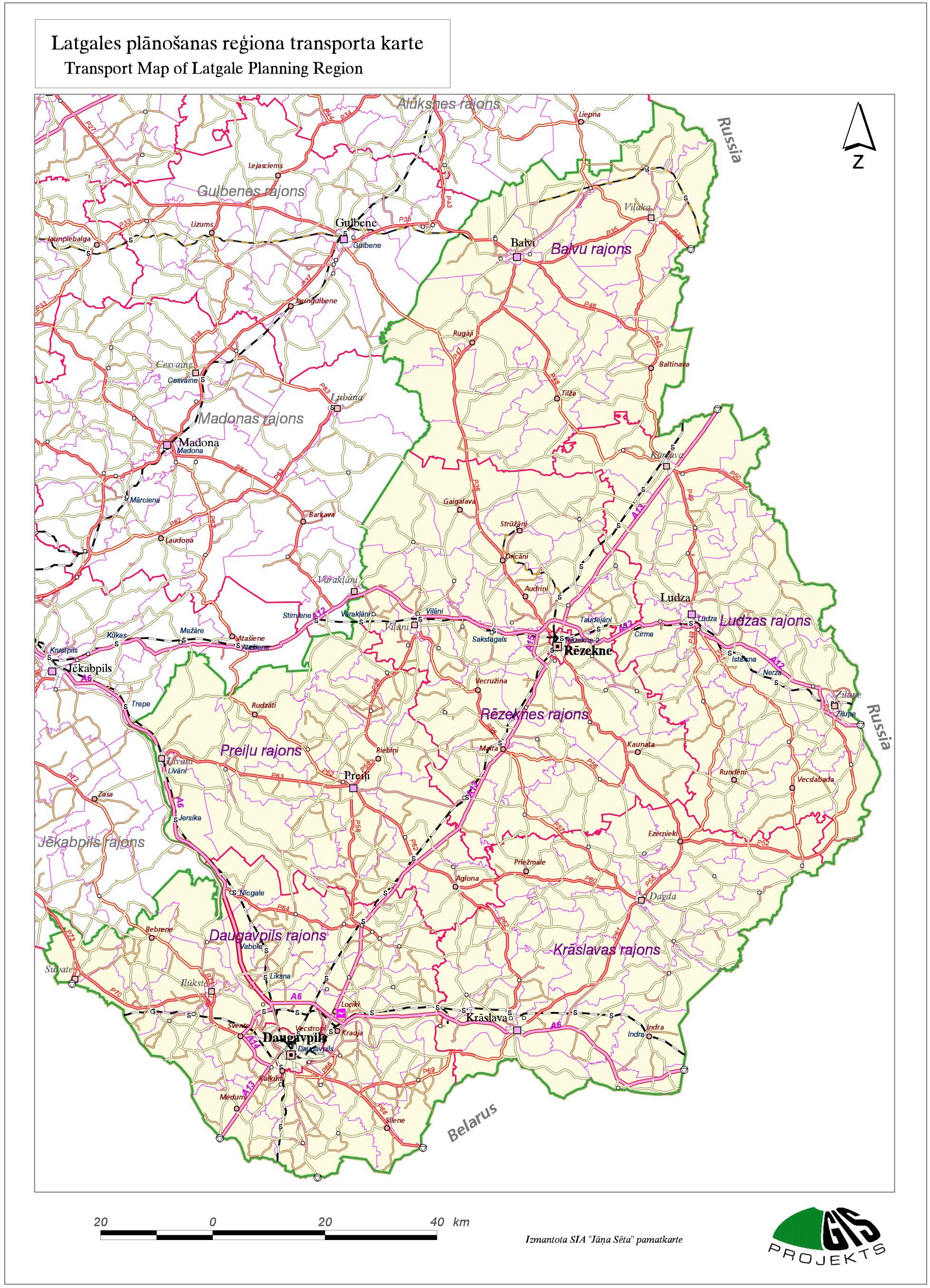
Distances of motor roads from Rezekne to the biggest cities
Moscow – 720 km
St. Petersburg – 489 km
Minsk – 379 km
Helsinki – 490 km
Stockholm – 605 km
Berlin – 1269 km
Distances from City Rezekne to the nearest airports
Riga – 242 km
Vilnius – 305 km
Kaunas – 301 km
Daugavpils* – 75 km
* – in the stage of development